


BOLO Voting District, Maricopa County, Arizona
About
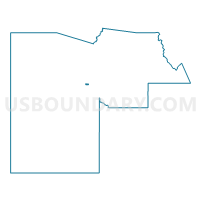
Outline

Summary
| Unique Area Identifier | 524732 |
| Name | BOLO Voting District |
| County | Maricopa County |
| State | Arizona |
| Area (square miles) | 1.12 |
| Land Area (square miles) | 1.12 |
| Water Area (square miles) | 0.00 |
| % of Land Area | 99.76 |
| % of Water Area | 0.24 |
| Latitude of the Internal Point | 33.45365520 |
| Longtitude of the Internal Point | -112.36022600 |
Maps


Graphs
Select a template below for downloading or customizing gragh for BOLO Voting District, Maricopa County, Arizona


Neighbors
Neighoring Voting District (by Name) Neighboring Voting District on the Map
- AVONDALE 1 Voting District, Maricopa County, AZ
- GOODYEAR Voting District, Maricopa County, AZ
- PALM VALLEY Voting District, Maricopa County, AZ
- RIO PASO Voting District, Maricopa County, AZ
- SANTA FE Voting District, Maricopa County, AZ
- WILDFLOWER Voting District, Maricopa County, AZ
Top 10 Neighboring County Subdivision (by Population) Neighboring County Subdivision on the Map
Top 10 Neighboring Place (by Population) Neighboring Place on the Map
Top 10 Neighboring Elementary School District (by Population) Neighboring Elementary School District on the Map
Top 10 Neighboring Secondary School District (by Population) Neighboring Secondary School District on the Map
Top 10 Neighboring State Legislative District Lower Chamber (by Population) Neighboring State Legislative District Lower Chamber on the Map
Top 10 Neighboring State Legislative District Upper Chamber (by Population) Neighboring State Legislative District Upper Chamber on the Map
Top 10 Neighboring 111th Congressional District (by Population) Neighboring 111th Congressional District on the Map
Top 10 Neighboring Census Tract (by Population) Neighboring Census Tract on the Map
- Census Tract 610.09, Maricopa County, AZ (8,318)
- Census Tract 610.12, Maricopa County, AZ (7,680)
- Census Tract 612, Maricopa County, AZ (6,114)
- Census Tract 613, Maricopa County, AZ (1,930)